About This Service

Designing Transit Wayfinding That Riders Trust

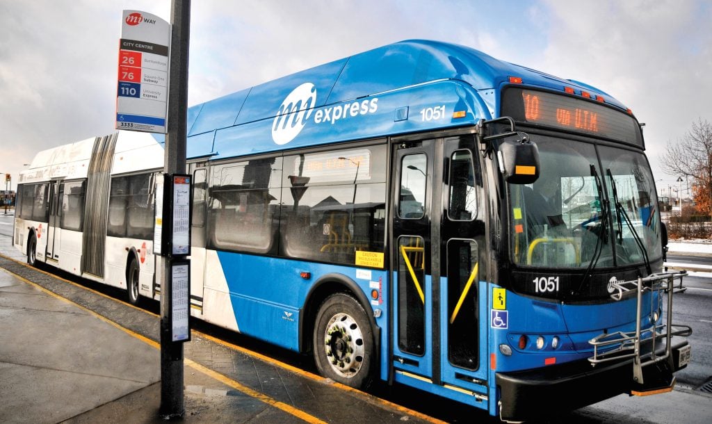
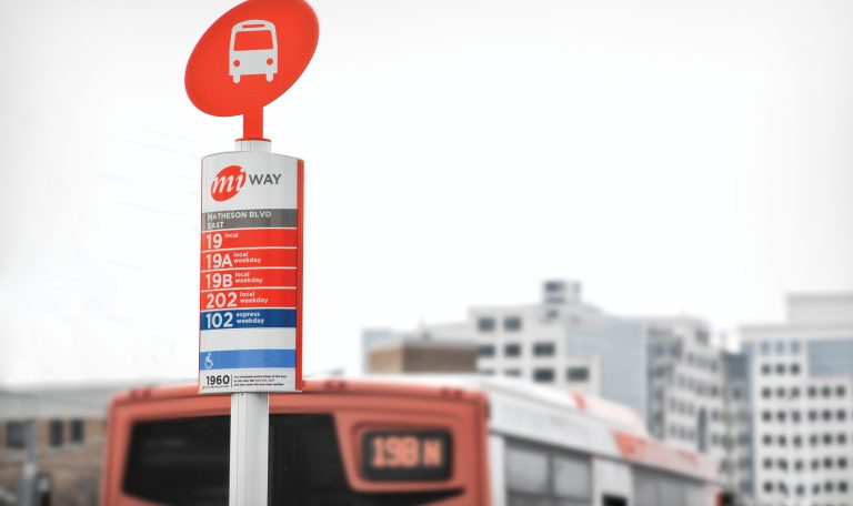
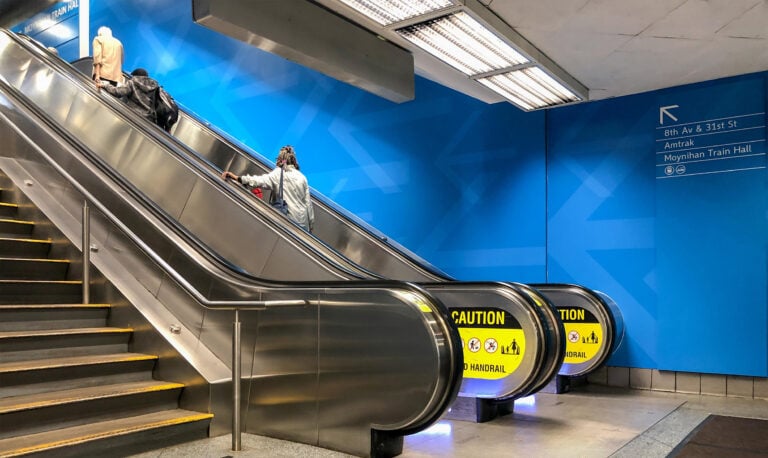
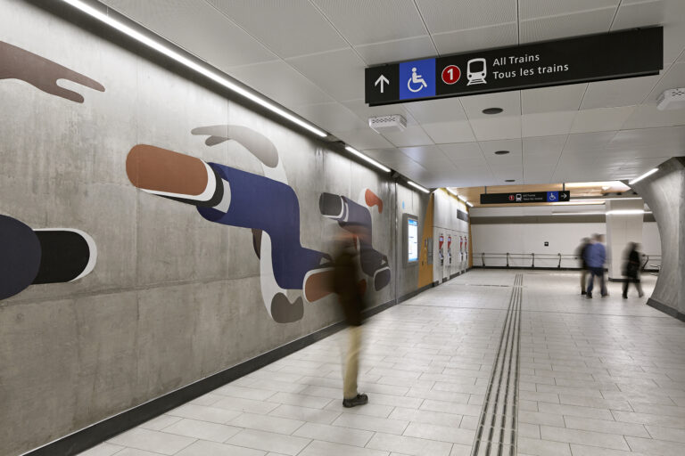
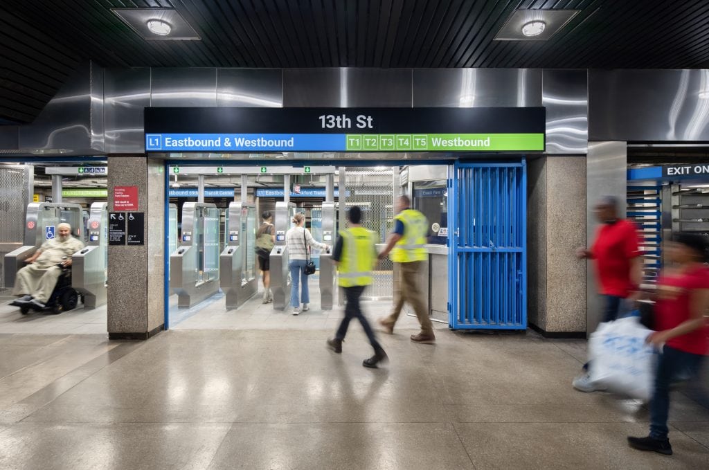
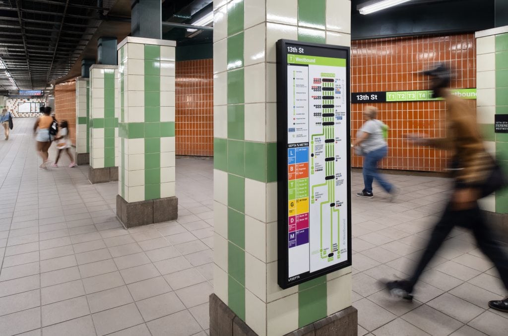
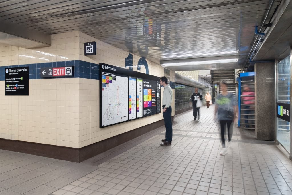
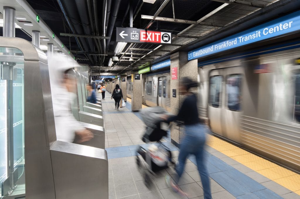
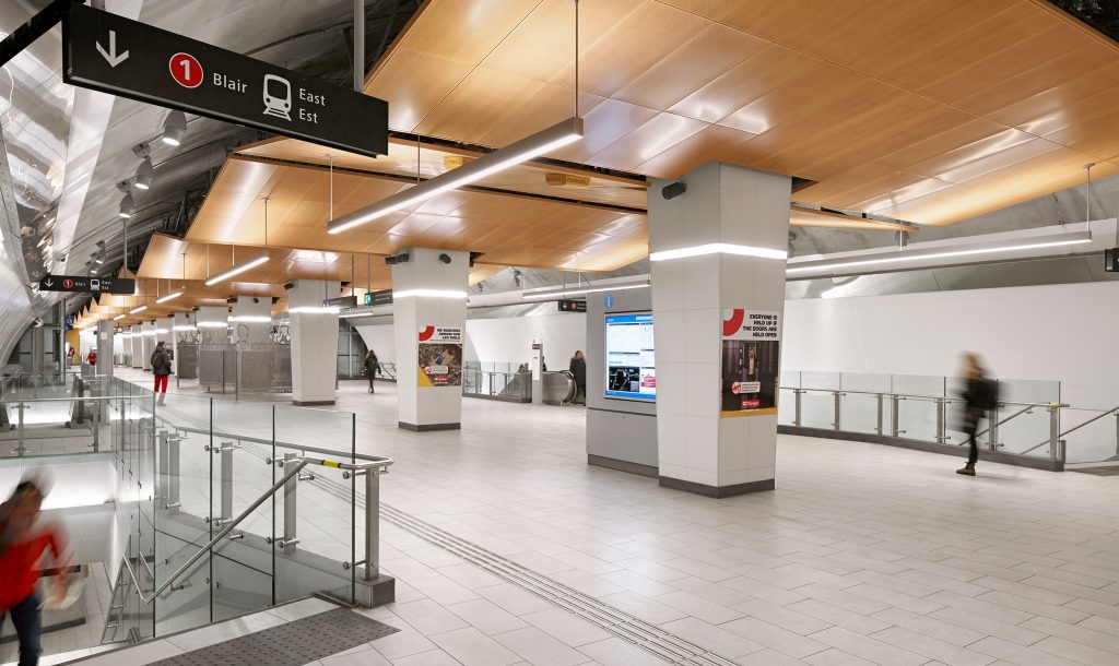
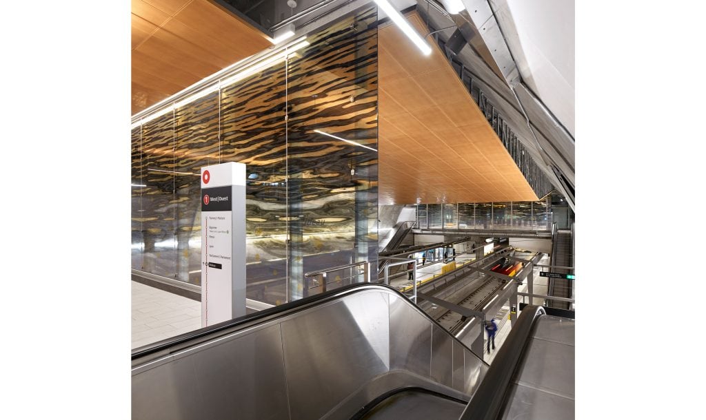
Millions of people rely on transit wayfinding every day, and it functions at a scale and speed that is unmatched by any other setting. Riders make decisions in a matter of seconds, frequently underground and without landmarks. There is no room for misunderstanding.

We collaborate with transit authorities, architects, and planners from the earliest concept through system roll-out—using behavioral research, field testing, and phased delivery to place information where decisions happen. Our work includes the GTHA harmonization, the SEPTA Metro master plan, and Union Station’s multi‑modal strategy.

People move from street to platform to train without hesitation when transit wayfinding is effective; transfers feel manageable, exits lead where expected, and unfamiliar trips become readable. The end product is an approachable, dependable, and readable system.

Transit Wayfinding Signage

Featured Work

Transit Wayfinding Projects

MiWay

Transit

MiWay Mississauga Transit

Complete transit rebranding wayfinding

New York’s Penn Station

Transit

New York Penn Station

Unified multi-level transit wayfinding

Overhead directional sign adjacent to a wall mural in an OC Transpo station.

Transit

OC Transpo

Seamless multi-service transit navigation

Map Signage

Transit

Southeastern Pennsylvania Transportation Authority (SEPTA)

Research-driven accessible transit wayfinding

Entro

Transport wayfinding connects people to destinations, making multi-modal journeys straightforward and stress-free.

Need wayfinding for transits? Let's talk.

Signage Solutions

Types of Transit Wayfinding Signage

Transit wayfinding is a system that helps a person move from the street to the platform to the final destination, including the connections in between.

01

Station entrance & street‑level signage

Transit wayfinding starts above ground, with station signs, entrance markers, and accessibility indicators helping riders find the right entry from the street. These signs need to be easy to read quickly, even with all the storefronts, signs, and moving traffic. The placement and contrast are very important so that a rider can find the right entrance without stopping.

Station Identification
Entrance Markers
Accessibility Indicators
Entrance Signage
02

Concourse & circulation signage

Concourse wayfinding guides passengers through fare zones, past ticketing, and to the appropriate platform or transfer. In both off-peak quiet and rush hour crowds, overhead directionals, line identifiers, and clear transfer paths must be readable.

Platform Directionals
Line Identification
Transfer Signage
Platform Directionals
03

Platform & boarding signage

Maps, next-train indicators, safety markings, and accessibility cues are examples of platform signage that verify line, direction, and boarding zone. Type size, sightlines, and mounting height are important because they help passengers in the last seconds before a train arrives. A quick look should provide an answer: Am I using the correct platform?

Line Maps
Boarding Zones
Safety Markings
Map Signage
04

Exit & destination signage

Exit signage links the station to the surrounding neighborhood by naming streets, landmarks, and transit connections. Clear exit information prevents long detours and helps riders emerge exactly where they intend. In large stations, exit logic is the difference between surfacing at your destination or three blocks away.

Exit Identification
Street Connections
Neighborhood Maps
Exit Signage
05

Accessibility & information signage

Elevator locations, tactile routes, braille, and simple language support riders with diverse needs. Information panels and service alerts serve everyone with network maps and real‑time updates. These elements must be maintained and updated reliably—stale accessibility information is worse than none at all.

Elevator Identification
Accessible Routes
Service Information
Informational Signage
06

Multi‑modal connection signage

Stations connect to buses, bike‑share, ride‑hail zones, park‑and‑ride, and airports. Connection signage bridges these modes so people transfer without leaving the wayfinding logic. At hubs like Union Station, this layer holds the whole passenger experience together—making multi‑step journeys legible and efficient.

Bus Connections
Bike & Ride‑Hail |
Park‑and‑Ride
Multi-Modal Signage

FAQ

Wayfinding Transit Signage

Common questions about transit wayfinding design for stations, networks, and multi‑modal systems.

Transit wayfinding faces unique time pressure. People should decide in a matter of seconds, frequently when a train is on its way. There is little room for error and greater stakes. In order to prevent riders from having to relearn logic at every station, signs must be consistent, easily readable, and placed where decisions are made.

The basis is consistency. Riders can read a single map at any station using color, typography, icons, sign types, and placement logic. Spatial literacy increases when the rules apply to all stops and lines. This makes travel predictable and less mentally taxing for both regular and infrequent users.

We develop a shared navigation framework that unifies important components while respecting agency identity. In order to provide riders with a single, cohesive system during transfers without erasing each operator's brand, we harmonized signage across ten agencies in the GTHA. As a result, navigating across jurisdictional boundaries is smooth.

Transit is public infrastructure and must work for everyone. We create simple language, Braille, elevator wayfinding, high-contrast graphics, and tactile guidance so that individuals with a range of abilities can navigate on their own. Predictable sign placement and logical sequencing, or cognitive accessibility, minimize mental strain and promote a sense of community.

Yes. We develop modular standards and documentation so new stations adopt the same visual language from day one. The system should feel unified, whether a station opened decades ago or yesterday, so growth becomes an opportunity to reinforce clarity, not erode it.

While static signage anchors permanent information like station names and exit maps, digital elements provide real-time information on upcoming train arrivals, platform changes, and service alerts. In order to provide riders with consistent orientation cues and timely updates when the network changes, transit wayfinding integrates both.

Timelines vary by scope. A station‑level programme typically takes four to eight months. System‑wide programmes spanning multiple lines and agencies often take one to three years, phased to align with construction and openings. Please confirm these ranges with project stakeholders and Entro scheduling.

Let's Work Together

Ready to Shape Your Transit Wayfinding

We design transit wayfinding that builds rider confidence, supports network consistency, and creates a system that feels welcoming to every passenger.

Free consultation
24hr response
No obligation